
Walk a Stevens Point Street
A street-by-street search works as a chain. Stevens Point property data identifies an assessed owner and a stable parcel. Portage County GIS adds the parcel shape, nearby lots, road names, districts, and municipal boundaries. Recorded instruments show legal interests over time. A dated directory or voter tool can add evidence that a person was tied to the address, but neither is a complete roll of everyone present. Keep the search date, exact address form, parcel number, legal description, name, and role shown.
- Normalize the address, then search the city portal by house number and street name.
- Open the parcel in county GIS and note its boundaries, parcel ID, municipality, and legal description.
- Use the owner and legal description to locate recorded instruments through the county route.
- Check MyVote by address only for the public registration question that official tool answers.
- For an earlier household, use a dated street section or criss-cross directory and preserve its volume and page.
Stevens Point Address Search Fields
The City of Stevens Point property search is the main address-keyed entry point inside city limits. It offers current and historical property choices, though the full historical year range is not stated. City tax instructions say to omit the 281 prefix, dots, and dashes from a parcel number, and to omit “Street” and the street type from the Street field.
| Field group | Controls shown | Research use |
|---|---|---|
| Record type | Parcel; real estate or personal property | Separate land from personal-property accounts |
| Parcel | Parcel and alternate parcel number | Reuse a stable property key |
| Owner | Last name, first name, owner status | Verify against address and date |
| Address | House number, directions, street name and type | Search one site or a named street |
| Survey | Plat, section, township, range, fractional selectors | Recover a parcel after an address change |
| Context | Municipality; current and historical properties | Separate jurisdictions and time periods |
View the official parcel form before entering data.
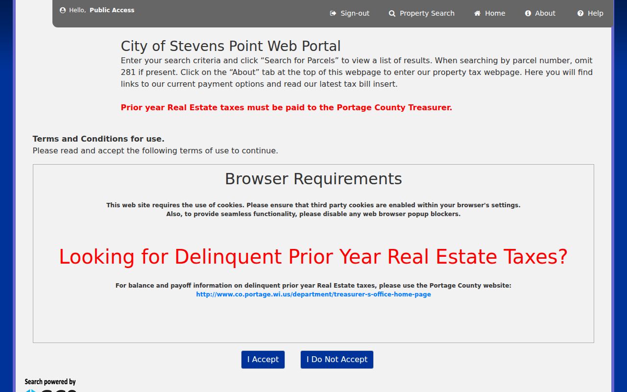
The owner, parcel, address, survey, municipality, and time controls provide several paths back to one property.
Map Stevens Point Street Parcels
The Portage County Land Information service supplies the spatial half of the search. Its public data includes tax parcels, addresses, roads, zoning and land use, plus municipal and voting boundaries. County planning material says all parcels are digital. This is useful when similar addresses lie in different municipalities or one street name returns many records.
Open the subject parcel and save its ID and legal description. Then inspect visible adjoining parcels. The reviewed interface did not document a fixed buffer or radius tool, so do not promise one. Ownership shown on the map is still not proof of occupancy.
Start from the Portage County public ArcGIS hub.
The map gives each address geographic context and makes adjacent parcel checks practical.
Note: Record the USPS mailing line and the GIS municipality separately when a Stevens Point address sits near a jurisdiction boundary.
Stevens Point Records by Street
No address source covers every resident role. A Stevens Point street directory is reliable only when each record is used for the limited fact it states. The parcel number ties assessment data to mapping and land research. The address ties dated directories and permits to the site, subject to number changes.
| Record Set | Keeper | What It Shows | Access |
|---|---|---|---|
| Property and tax roll | City assessor and finance staff | Owner, mailing and property addresses, value, legal description | City portal; staff at 715-346-1553 ext. 2 |
| GIS parcel map | Portage County Land Information | Parcels, roads, addresses, districts, adjoining lots | Public ArcGIS hub; office at 715-346-1334 |
| Recorded land | Portage County Register of Deeds | Grantor, grantee, instrument, date, legal description | Tapestry, office, phone, genealogy appointment |
| Voter lookup | Wisconsin Elections Commission | Public registration information for a supplied query | MyVote; clerk fallback |
| Permits and code files | City Community Development | Application, work site, named project roles, action | Department inquiry or records request |
When a portal fails, call or visit the custodian, or request a specific existing record. Portage County accepts focused requests through NextRequest under Wisconsin Public Records Law, Wis. Stat. §§19.31–19.39.
Stevens Point Street Record Terms
Clear terms prevent false matches when the tax roll, map, deed, and directory seem to disagree. Keep these meanings with the source log.
- Parcel
- A mapped unit of land with a public identifier. One address may involve several parcels.
- Situs address
- The property's physical address, which may differ from the owner's mailing address.
- Plat
- A recorded map dividing land into lots, blocks, streets, or surveyed areas.
- Criss-cross directory
- A directory arranged by street or address rather than only by surname.
A legal description often lasts longer than a street number. Carry the lot, block, certified survey map, or public-land-survey reference forward whenever it appears.
Stevens Point's 1965 Address Bridge
Stevens Point has a rare tool for crossing an address break. The Portage County Historical Society renumbering guide used names from the 1964 Polk directory. Its present-number, occupant, and new-number columns connect addresses across the city-wide change effective August 1, 1965.
The bridge is a lead, not proof. Downtown numbers generally advanced about four digits, while residential numbers generally advanced about eight digits per lot. Verify any pair against a legal description, later tax roll, directory page, deed, or map. An absent match can reflect spelling, rebuilding, or incomplete coverage.
The city code sets Maria Drive as the north-south baseline. The Wisconsin River and a line 6,300 feet west of Division form the east-west baseline. Blocks rise by hundreds, with even numbers on north and west sides and odd numbers on south and east sides.
Deeds Along Stevens Point Streets
The Portage County Register of Deeds keeps recorded land instruments and legal descriptions. The county links Tapestry as its online route. Current official material does not establish a complete online cutoff, full field list, or free image policy, so do not invent one.
Search with a parcel or legal description, then use grantor and grantee names within a narrow date span when the interface permits it. Distinguish deeds from mortgages, releases, easements, covenants, plats, and probate-related filings. None proves occupancy by itself.
Open the county-linked Tapestry route and check its current terms.
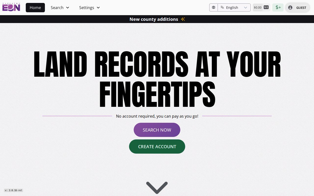
The captured entry screen identifies the vendor-hosted access point, while the county office remains the authority for older books and copies.
If the online index fails, call 715-346-1428 or use the office at 1516 Church Street. Genealogy appointments have narrower Monday through Thursday hours.
Residents Beyond Stevens Point Owners
Assessment data shows ownership, not a full household. A tax bill may go elsewhere, and a trust or estate may be named. For a dated occupant question, move from the parcel to a resident source.
Wisconsin MyVote offers a name route requiring first name, last name, and birth date, plus an address route using street, unit, city, and ZIP. Its result concerns registration and voting history. It is not a census and never reveals ballot choices. For historical households, use the collections described on the Stevens Point city directory page.
Permits may name an owner, applicant, designer, or contractor. Agendas and special assessments can connect a site to an official action. Preserve the role. A public name beside an address does not automatically show residence.
Sanborn Maps Frame Stevens Point
Fire-insurance maps add building context to a street directory. Official metadata identifies Stevens Point Sanborn years 1884, 1891, 1898, 1904, and 1912. Sheets show street names, footprints, materials, use, outbuildings, and fire-risk details, but they do not usually name residents.
See the Wisconsin Historical Society's 1891 image record. Align it with a modern parcel only after checking the sheet key, orientation, street, number, and legal description.
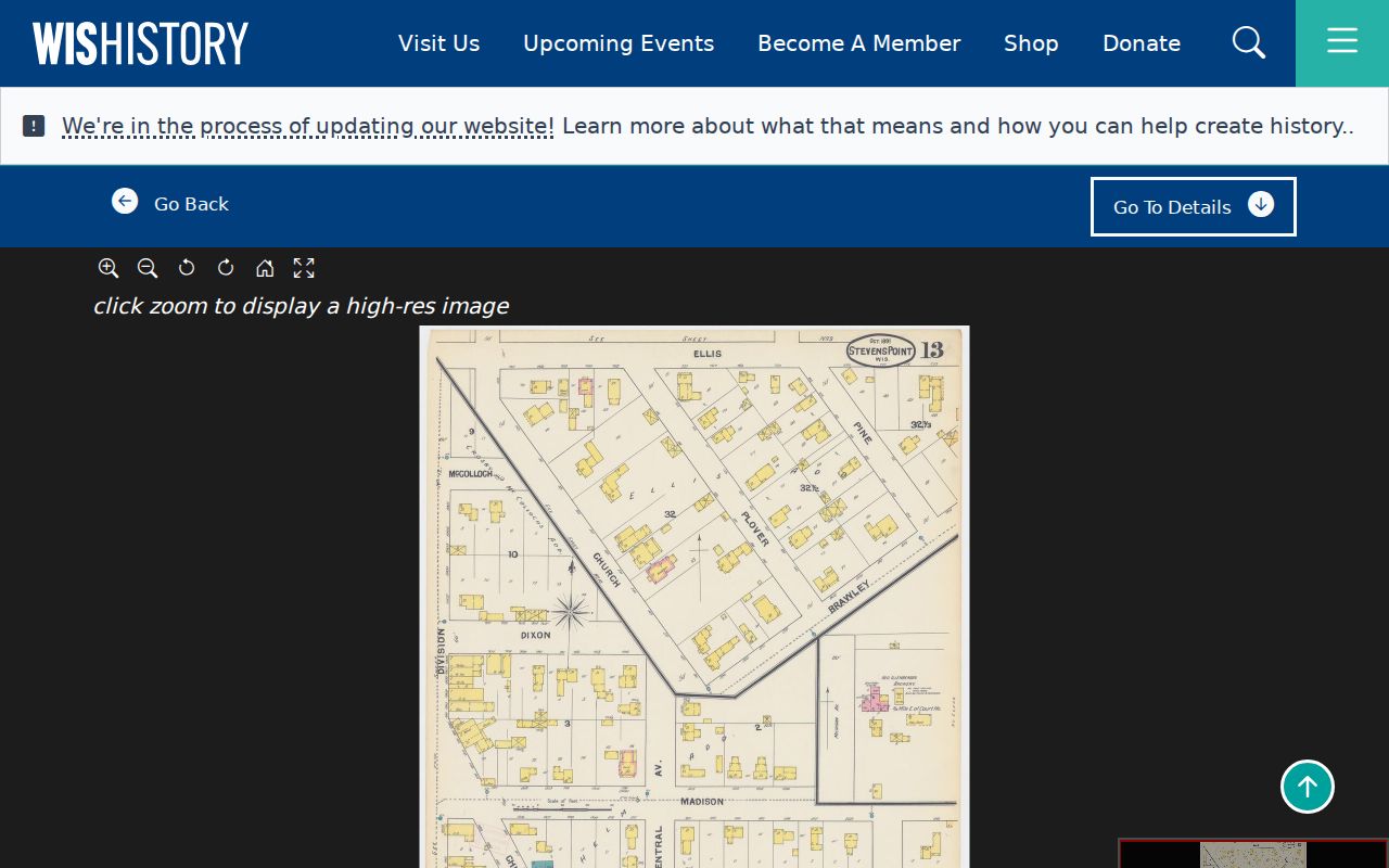
The historical map supplies physical context where a changed number or rebuilt block interrupts the address trail.
Limits of Stevens Point Street Records
A street directory cannot produce a complete, current list of all people at each address. Property data identifies ownership and mailing roles. MyVote answers a registration query within its rules. Directories are dated snapshots. GIS maps parcels, not households. A missing result may reflect an old number, wrong municipality, spelling variant, index gap, sealed record, or protected address.
Safe at Home can substitute an address for eligible participants, and Wis. Stat. §6.47 can restrict voter information. Do not combine protected details with parcel data to defeat those safeguards. Report only what a source states and include its date.
A careful Stevens Point street directory also distinguishes a portal search from a records request. Search tools return only the data, years, and fields placed in that system. A custodian may hold an older assessment roll, permit packet, map, deed book, or meeting record that has never been indexed online. Ask for one record class, one address or parcel, and a useful date span. Request an existing electronic copy when one is maintained, set a fee ceiling, and ask the office to identify the basis for any redaction.
Keep negative results narrow. Write that the city parcel portal returned no matching property under the tested address on the search date, or that the online land index did not expose the expected instrument. Do not turn either outcome into a claim that the parcel, owner, occupant, or event never existed. Try the old and new street numbers, parcel number, alternate parcel number, legal description, public-land-survey fields, spelling variants, and the correct municipality before closing the search.
Current facts can change quickly. Assessment rolls have an annual status date, voter information changes, deeds are recorded, parcels split, and office access terms can be revised. Save a PDF, image, instrument number, volume and page, or request ID when permitted. A repeatable source trail is more useful than a copied name with no date or record role.
Tax records add another dated layer to the Stevens Point street directory. The city tax lookup can reprint a bill, show payment dates and payment history, report a due balance or payoff, and display the owner name and address used when the bill was issued. Those fields document the tax account at that point in time. They do not establish that the addressee occupied the parcel. If earlier delinquent real-estate taxes are relevant, the city directs that question to the Portage County Treasurer at 715-346-1348. Keep the bill year beside every name because the current assessment and an older tax bill may reflect different owners.
Paper maps are also available when a digital viewer is not enough. Portage County publishes a Land Information map fee schedule based on sheet size, from $1 for an 8.5 by 11 inch sheet through $10 for a 34 by 44 inch sheet, with a general rate of $1 per square foot. Confirm the current charge before ordering. A printed map can preserve parcel lines, road context, and the research date, but it still needs the assessment roll or deed index for names and legal roles.
For permit history, ask Stevens Point Community Development for a narrow address and date range. A permit application may include the building location, legal description, owner or building-land name, designer, plans, survey, and proposed work. State exactly whether a name appears as owner, applicant, designer, or contractor. The permit proves an application or official action described in the file, not that the work was completed or that each named person lived on the street.
Lawful use. Stevens Point address records support lawful personal, family-history, property, and civic research. Wisconsin stalking and harassment laws, Wis. Stat. §§940.32 and 947.013, prohibit harmful misuse.